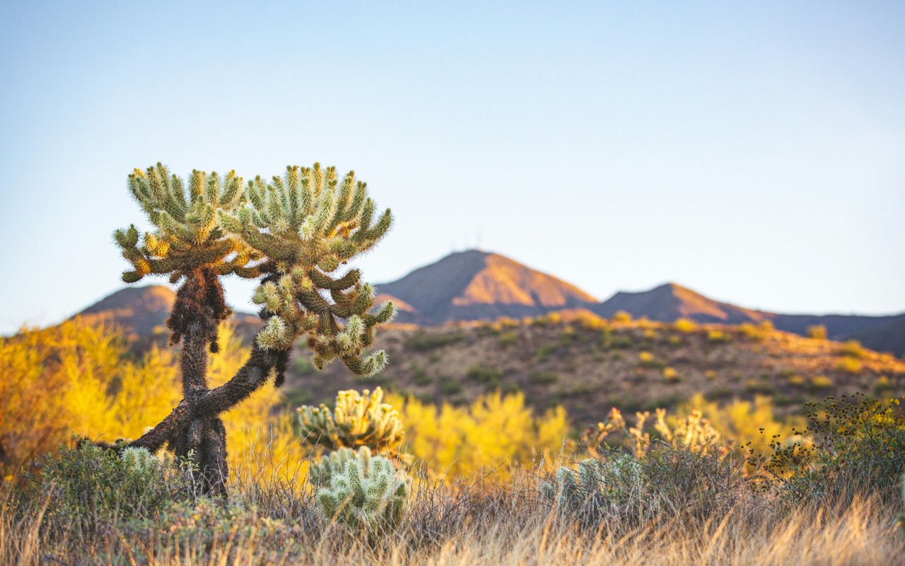
Ask three different North Phoenix neighbors where they hike the Sonoran Preserve and you'll likely get three different answers that never overlap. That's not a coincidence of habit. The preserve covers more than 9,600 acres split across three trailheads, and each one leads into a different kind of day. Treat them as the same park with three parking lots and you'll end up on the wrong trail for what you actually wanted to do this weekend.
That distinction matters more than usual right now. Phoenix and Maricopa County's annual open-fire ban, in place since May 1 because of continued drought and elevated wildfire risk, runs through September 30. We're twenty-four days out from that date. Combine the ban lifting with mornings that are finally cooling off, and the next few weeks are when North Phoenix trail traffic usually picks back up after a long, quiet summer. Knowing which trailhead actually matches your plans saves you a wasted drive.
Apache Wash Is Built for Wheels, Not Just Boots
Start at Apache Wash Trailhead, at 1600 E. Sonoran Desert Drive, and you're standing at the only entrance to the preserve with paved, ADA-accessible trail built specifically for something other than boots. The East and West Skip Rimsza Paseo, dedicated in 2013, run in either direction along Sonoran Desert Drive with a grade so gradual it barely registers as a climb. It's the trailhead that works for a jogging stroller, a grandparent who wants fresh air without switchbacks, or anyone easing back into outdoor time after a summer spent mostly indoors.
Apache Wash is also where Sidewinder Trail begins, right behind the trailhead ramada, before it climbs east around Apache Hill toward Apache Vista. From this same lot you can pick the flat 2.9-mile out-and-back Apache Wash Trail, the longer Badger Brawl connector, or start the technical push that eventually reaches the preserve's communication towers deep in the north flats. One parking lot, two entirely different intentions.
The drought context is worth sitting with for a moment. Jennifer Waller, director of Maricopa County Parks and Recreation, put it plainly when this year's ban went into effect: "Maricopa County continues to experience below-average rainfall, and our desert vegetation is extremely dry. As temperatures rise, so does the risk of wildfire." That's the backdrop for why the ban stretches a full five months this year rather than a shorter stretch, and why its expiration on September 30 is worth marking rather than assuming.
Desert Vista Is Where the Summits Are
Drive to Desert Vista Trailhead, at 1900 W. Desert Vista Trail, and the menu changes entirely. There's no paved paseo here. Instead you get Hawks Nest Trail feeding into Desert Tortoise Trail, Valle Verde, Great Horned Owl, and eventually Union Peak, which rewards the climb with a genuine 360-degree view. If your goal is a summit photo rather than a flat evening walk, this is the lot you want, not Apache Wash.
Desert Tortoise Trail carries a specific warning worth repeating for anyone bringing a dog: the trail runs close enough to cholla cactus on both sides that a poorly leashed dog can end up in real trouble fast. Great Horned Owl Trail is the steepest of the bunch, with enough elevation change that the City of Phoenix's own trail notes suggest tackling it clockwise so the punishing climb comes at the start rather than the finish, when you have less in the tank. Dixie Summit Trail, reached via the Dixie Mountain Loop, is described by the city as strenuous with switchbacks the whole way up, and it's paired with Union Peak as the two routes to the tallest points in this half of the preserve.
Hawks Nest Trail carries an unusually direct piece of guidance in the City's own trail notes: it's best used from September through May, not during the hottest stretch of summer. That's not marketing language. It's a practical window, and it opens right about now.
Desert Hills Feeds the Technical Middle of Sidewinder
The third door, Desert Hills Trailhead at 705 W. Carefree Highway, gets the least foot traffic of the three, and that's largely because it drops you into the more technical middle section of Sidewinder Trail rather than the easier stretch near Apache Wash. This is the entry point mountain bikers use to reach the trail's tight washes and steady climbs as it works its way toward the communication towers and back down through a section the city's own trail guide calls a "highway gore point" near the Central Avenue connector.
If you're a hiker looking for a casual outing, Desert Hills isn't where you want to end up. If you ride and you've already worn out the easier loops off Apache Wash, it's the trailhead that finally gives Sidewinder its full difficulty.
None of the Three Have a Water Fountain
Here's the fact that applies equally to all three trailheads and trips up more first-time visitors than any trail choice: there is no potable water anywhere in the Sonoran Preserve. Not at Apache Wash, not at Desert Vista, not at Desert Hills. Every trailhead has vault toilets and shade structures at the parking lot, and that's where the amenities end.
This isn't a minor inconvenience. The City of Phoenix reports that more than 200 hikers are rescued annually from its desert parks and preserves, a number tied closely enough to heat and hydration that the city built an entire Trail Heat Safety Program around it in 2021. That program layers extra daytime restrictions onto specific trails citywide whenever the National Weather Service issues an Extreme Heat Warning, closing routes like Echo Canyon on Camelback Mountain or the Piestewa Peak Summit Trail between 8 a.m. and 5 p.m. until conditions ease. The Sonoran Preserve posts its own version of these alerts directly on its trail page when conditions warrant it. None of that changes the baseline rule: bring more water than you think you need, because you cannot buy or refill it once you're past the parking lot.
Matching the Trailhead to Your Actual Weekend
Once you know what each door leads to, picking the right one is straightforward.
- Want a flat evening walk with a stroller or an aging parent who doesn't want switchbacks: Apache Wash's paved Skip Rimsza Paseo.
- Chasing a summit view for the sake of the view: Desert Vista, via Union Peak or the Dixie Mountain Loop to Dixie Summit.
- Riding technical singletrack and tired of the easy stretch near Apache Wash: Desert Hills, into Sidewinder's middle section.
- Introducing an out-of-town guest to the desert without committing to serious elevation: Apache Wash Loop or the Badger Brawl connector, both manageable in under two hours.
When You Want a Day That Isn't a Trail
Some weekends, the answer is to skip the desert entirely. The Musical Instrument Museum on Mayo Boulevard runs galleries and live programming that make for a good counter-program on a day when the trails feel like too much sun. Reach 11 Recreation Area offers close to 18 miles of multi-use trail plus athletic fields and picnic space for a lower-key outing, and Deem Hills Recreation Area, at nearly 1,000 acres, gives you trail variety without the crowd Apache Wash sometimes draws on weekend mornings.
The next few weeks are the payoff for a long, hot stretch of staying indoors. The fire ban lifts September 30. The best hiking window the city itself points to for trails like Hawks Nest and Apache Wash runs right through the fall and winter ahead. Whichever door into the preserve fits your weekend, the timing has finally caught up with the intention.
If you're a North Phoenix homeowner thinking about what comes next for your property, or you're weighing a move into or out of the area and want a local read on the market rather than a national one, Ragini Sejpal is a resource worth reaching out to. Let's Connect.